Green River's Uphill Battle: How a Mountain Range May Have Subsided to Let a River Pass
They Bypassed the River & Went *THROUGH* the Mount...
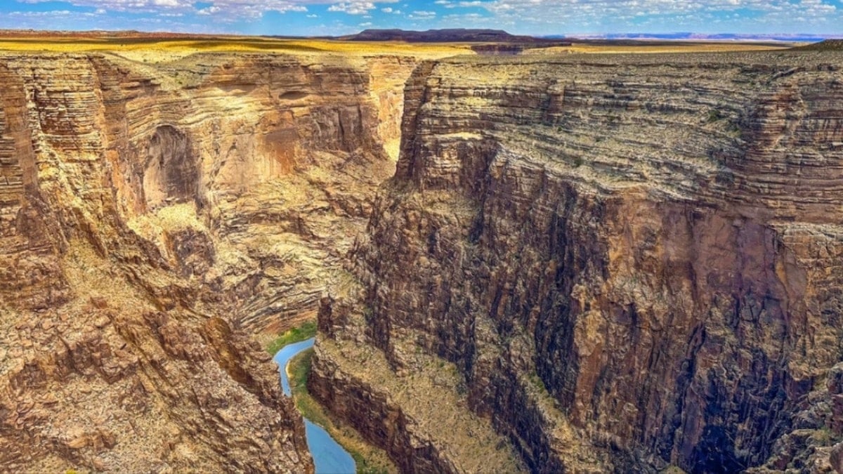
For millions of years, the Green River, the Colorado River's largest tributary, has done something truly baffling: it's carved a path straight through the Uinta Mountains. This isn't some gentle meandering around the foothills; the river punches right through them. It's a geological head-scratcher that's puzzled scientists for ages. Now, a new study is throwing a truly wild idea into the mix: what if the mountains themselves temporarily sank, allowing the river to seemingly flow *uphill*?
The Green River, for those not familiar with the area, starts its journey in Wyoming and eventually merges with the Colorado River in Utah's stunning Canyonlands National Park. And here's the kicker: about 8 million years ago, it decided to carve its way through the Uinta Mountains, which top out at a respectable 4,000 meters. But the mountains themselves are ancient – about 50 million years old. So, the river's current course is relatively recent – maybe in the last 8 million, maybe even just the last 2 million years. That huge age difference is what's been keeping geologists up at night.
Up until now, there have been two main theories. One suggested the Yampa River, located south of the Uintas, gradually eroded its way north, eventually creating a passage that the Green River could then exploit. The problem? It's hard to imagine the Yampa, which is relatively small, having enough oomph to carve out such a massive canyon. The other idea was that sediment buildup temporarily raised the level of the Green River, allowing it to spill over the mountains. But again, the sediment levels just don't seem high enough to account for the sheer depth of the canyon. I always thought both of those explanations felt a bit lacking, honestly.
According to a recent report in Livescience, this new study suggests something completely different – a period of subsidence, where the Uinta Mountains actually went *down*. The researchers propose that a process called lithospheric dripping caused dense rock masses beneath the mountains to sink, lowering the surface elevation. Then, get this, those dense masses detached and plummeted into the mantle, triggering a rebound effect that caused the land to rise again! The landscape we see today could be the result of this bizarre two-stage rollercoaster ride. It's almost too crazy to be true, but the evidence is starting to stack up.
Lithospheric dripping, in essence, starts deep down where the Earth's crust meets the mantle. The immense weight of the mountains can cause denser minerals to form. Over time, these heavier chunks "drip" downwards, pulling the surface down with them. And when they break off and sink completely into the mantle, the surface bounces back up. It’s like removing weight from a trampoline. Similar processes have been observed in other mountain ranges, like the Andes. So, while it sounds far-fetched, it's not entirely without precedent.
The researchers apparently used some clever modeling techniques to analyze the river profiles in the Uinta Mountains. They identified a distinctive bullseye-like pattern of uplift on the surface, which supports the idea of a localized rebound. And here's the real kicker: they also looked at existing seismic tomography data and found evidence of a detached, dense mass lurking about 200 kilometers beneath the Uintas. That’s pretty compelling evidence, if you ask me. It's a fascinating explanation that, if confirmed, could rewrite our understanding of how rivers and mountains interact. Definitely a story worth watching!
Comments
Please sign in with Google to post a comment
No comments yet. Be the first to comment!