Spain is bracing itself. A severe cold snap and disruptive weather are on their way, courtesy of a powerful cold front driven all the way from Greenland by Storm Ingrid. Seriously, Greenland to Spain? That's a long trip. The impending conditions are serious enough that the government has issued a national warning.
Greenland's Icy Fury Unleashed! Spain Braces for I...
Fueled by a stretched polar jet stream, this isn't just a little drizzle. Forecasters are predicting heavy rains, gale-force winds that could snap trees, coastal surges powerful enough to swamp promenades, and – perhaps most surprisingly – unusually low-altitude snowfall across much of the country. Sounds like someone skipped winter and went straight to "Arctic Apocalypse."
The state meteorological agency, AEMET, is taking no chances. They warn that Ingrid, named by the Portuguese meteorological service (IPMA), will bring high-impact weather to Spain starting Friday, January 23, and continuing right through the weekend. That's a good chunk of time to be dealing with this kind of mess.
Right now, a whopping 14 autonomous communities are on high alert. We're talking snow, rain, high winds, potential avalanches (from intense rainfall, no less!), and serious coastal hazards. Galicia, up in the northwest, is under a red alert, which signifies extreme maritime danger. Stay away from the coast, folks!
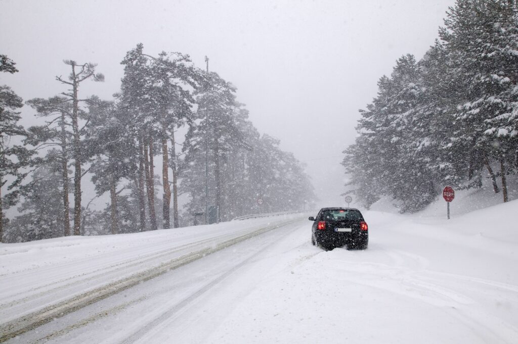
Here's the kicker: the potential for snow at *low* elevations. I mean, snow is pretty, but it's a real pain to deal with when you're not expecting it. The snow level could drop to between 200 and 500 meters above sea level in the northwest, and between 600 and 1,000 meters as far south as Malaga. That's going to impact huge areas, from the northern half of the country and central mountain regions to the southern ranges and parts of the southern plateau.
In some northwestern areas, accumulations of 5 cm or more of snow in 24 hours are possible even at low altitudes. Five centimeters? That might not sound like much, but trust me, it's enough to cause chaos on the roads and generally make life miserable. It's a dramatic return to proper winter conditions, blanketing landscapes in white far beyond just the high mountain peaks.
The National Civil Protection service has wisely issued an alert for the Atlantic storm and low-altitude snow across the northern third of the country, effective until Sunday, January 25. Better safe than sorry, right?
So, what's driving this madness? Apparently, Ingrid is expected to rapidly intensify northwest of Galicia, combining with the Azores High to create a strong northwest flow. This is basically channeling humid, polar air directly towards the Atlantic coast. A recipe for disaster, if you ask me.
The worst of it is expected on Friday and Saturday. Think risks of damage to coastal promenades, transportation disruptions due to snow, and serious maritime impacts. The good news? Conditions are expected to improve by Sunday as the storm weakens. So, at least there's an end in sight.
The bottom line? Residents are being urged to wrap up warmly, check on vulnerable neighbors to make sure they're well-stocked and staying warm, and – most importantly – stay informed about weather forecasts before even thinking about venturing outdoors. Stay safe out there, Spain!
Comments
Please sign in with Google to post a comment
No comments yet. Be the first to comment!