NASA Data Helps Maine Oyster Farmers Choose Where to Grow
NASA Tech to Save Maine Oysters?! Farmers Stunned ...
Maine oyster farmers are getting a high-tech assist from an unlikely source: NASA. Satellite data, typically associated with exploring distant planets, is now being used to optimize oyster farm locations and predict harvest readiness, offering a significant boost to the growing aquaculture industry.
For those unfamiliar, starting an oyster farm is no small feat. Location is everything, and historically, choosing the right spot has been a game of educated guesswork. But now, thanks to the ingenuity of researchers and the power of NASA's Earth-observing satellites, that guesswork is becoming a science. Farmers like Luke Saindon, director of The World Is Your Oyster farm in Wiscasset, Maine, are already reaping the benefits.
"Starting a farm is a big venture," Saindon stated, highlighting the risks involved. "If you choose the wrong spot, you can blow through a lot of money without ever bringing oysters to market." Saindon now uses a site-selection tool developed by University of Maine researchers, a tool that ingeniously leverages NASA satellite data to pinpoint areas with ideal water temperatures and abundant food sources – essential for oyster growth.
The implications of this technology are profound. It's not just about maximizing profits; it's about minimizing risk and ensuring the sustainability of Oyster farming in Maine. As Chris Neigh, the Landsat 8 and 9 project scientist at NASA’s Goddard Space Flight Center, points out, this is a prime example of how global data can have a very real, tangible impact on local communities. "We collect global data, but its value grows when it’s used locally to help communities work smarter and make their livelihoods more sustainable," Neigh said.
And the science backs it up. A study recently published in *Aquaculture* detailed how researchers combined temperature data from Landsat with plankton level estimates from the European Sentinel-2 satellite. This powerful combination allowed them to create a model that can accurately predict oyster growth rates. Imagine being able to anticipate harvest times with greater precision – that's the kind of power this technology offers.
Thomas Kiffney, a lead scientist on the study, explains that this model can help farmers make better decisions about seeding, harvesting, and production expectations, which ultimately reduces financial risks. Given that the Maine Oyster farming industry has seen impressive growth in recent years (a 78% increase in value between 2011 and 2021), the ability to fine-tune operations using NASA data is becoming more crucial than ever.
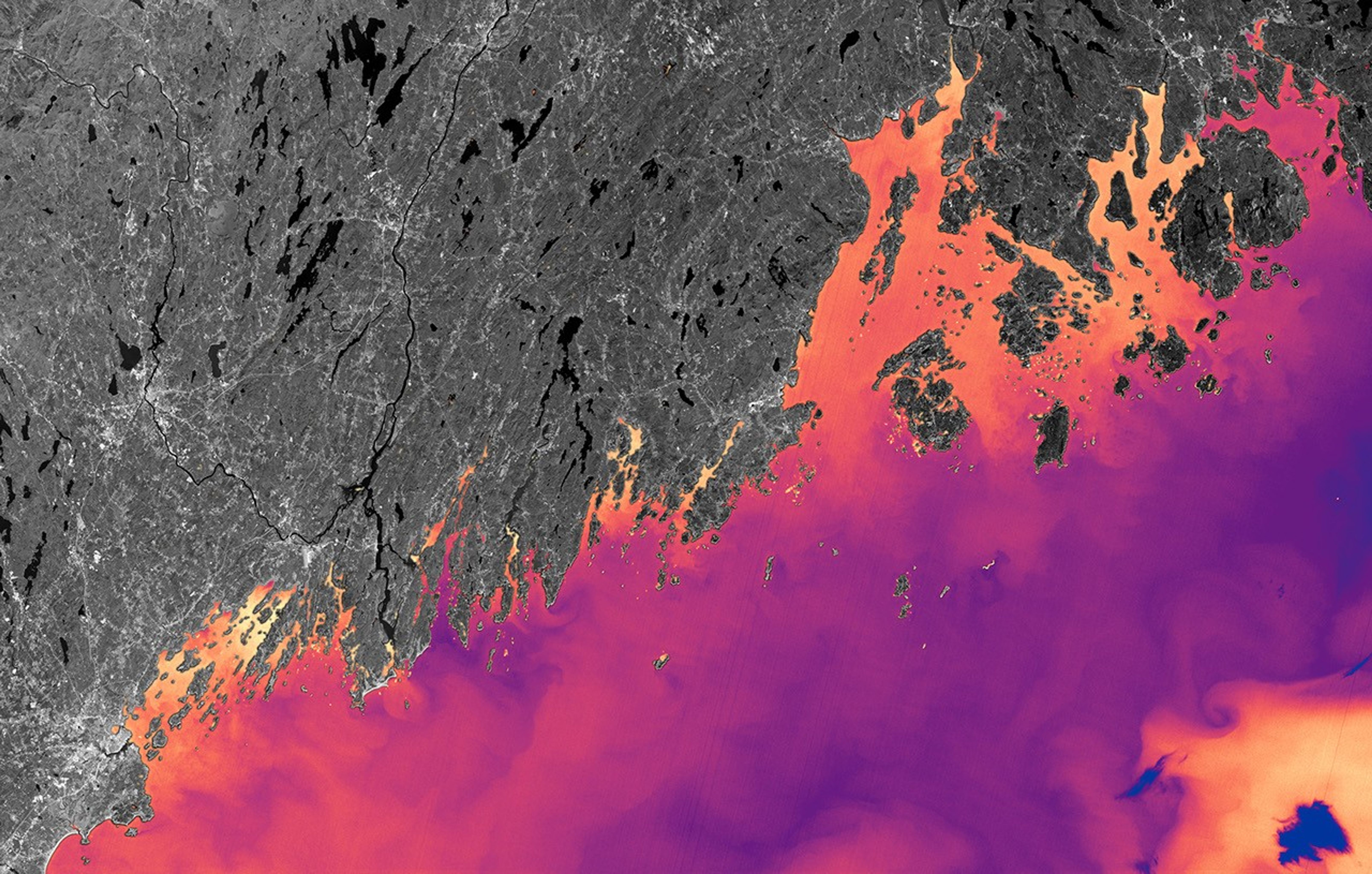
Damian Brady, another University of Maine scientist involved in the project, emphasized the long-term consequences of poor site selection. "It takes two to three years of scoping in order to get your permit to grow, and then it can take two years for those oysters to reach market," he explained. "So if you’ve chosen the wrong site, you’re four years in the hole right off the bat." Landsat's detailed coastal mapping capabilities are particularly useful in Maine, where the intricate coastline poses unique challenges. The satellite's thermal sensors can even detect subtle temperature variations between neighboring coves, giving farmers vital information for making informed decisions. It's a true testament to the power of collaboration and innovation, proving that sometimes, the solutions to our local challenges can be found in the most unexpected places – like space.
Comments
Please sign in with Google to post a comment
No comments yet. Be the first to comment!